The Japanese Alps and the Mountains at the Heart of Honshu
· 16 min read
The Japanese Alps are three mountain ranges across central Honshu, with peaks above 3,000 metres, a famous snow corridor, and a history that starts with an English missionary. Here is how they work, and how to see them.
The Japanese Alps are the tallest mountains in Japan after Mount Fuji, and the most surprising thing about them is how close they are to ordinary life. Trains run to their foothills, buses climb to 2,450 metres, and a ropeway can carry you over a dam that took seven years to build. Yet an hour up a trail, the crowds thin out, the air turns cold, and you are walking between peaks that top 3,000 metres.
The name covers three parallel ranges that run down the middle of Honshu: the Hida Mountains in the north, the Kiso Mountains in the centre, and the Akaishi Mountains in the south. Together they hold every mountain in Japan above 3,000 metres except Fuji itself. The highest is Mount Kita at 3,193 metres, a few metres taller than its northern rival Mount Hotaka at 3,190 metres.
This is a practical guide to the range as a whole: what each part offers, how an English missionary gave the mountains their name, how the famous Alpine Route crosses them, and how to plan a first visit without getting caught out by snow, season, or altitude.
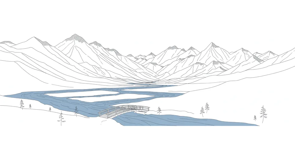
The first thing to understand is that the Japanese Alps are not one mountain range in the geological sense. The name is a convenient label for three ranges that happen to sit side by side in the middle of Honshu, separated by deep river valleys. The label stuck because it is useful, not because the rocks agree with it. Six prefectures share the high country, Niigata, Toyama, Nagano, Gifu, Yamanashi, and Shizuoka, and the mountains shape the weather, the rivers, and the towns around them. The heavy snow that falls on the western slopes feeds the Kurobe, the Azusa, and the Tenryu rivers, and it is the reason the valleys below stay green through the summer.
What the Japanese Alps actually are
The Japanese Alps sit in the widest part of Honshu, roughly between Nagoya, Toyama, and Matsumoto. Most of the northern and central high country belongs to Chubu Sangaku National Park, which covers 1,743 square kilometres across four prefectures. The southern range has its own park, Minami Alps National Park, established in 1964. Between them, the two parks protect a landscape of sharp ridges, deep gorges, cirques carved by old glaciers, and alpine meadows that bloom for a few short weeks each summer.
The mountains of the Japanese Alps are young in geological terms, still rising, and the relief is extreme. Valleys can drop 2,000 metres below the ridge in a few kilometres, which is why the rivers run so fast and the gorges are so deep. The Kurobe Gorge, cut by the Kurobe River between the Tateyama and Ushiro-Tateyama ridges, is one of the deepest in Japan. Snow lingers in shaded hollows into summer, and small glaciers still survive on Mount Tsurugi and Mount Tate, a fact that surprised researchers who once believed no glaciers existed in East Asia south of Kamchatka.
Wildlife follows the altitude. The rock ptarmigan, called raicho in Japanese, lives above the tree line and changes its feathers from brown in summer to white in winter. It is the symbol bird of the high mountains and a protected species. Lower down, the forests are beech and oak, then conifer, then the dwarf pine that marks the edge of the trees. In autumn the slopes turn in bands of colour, red maple low down, yellow larch higher up, which is why the Japanese Alps are one of the best places in the country to watch the autumn leaves without leaving the mountains.
The three ranges, north to south
The Northern Alps, or Hida Mountains, are the best known and the most visited. They stretch through Toyama, Gifu, Nagano, and a small part of Niigata, and they hold the Hotaka massif, Mount Yari at 3,180 metres, Mount Tate at 3,015 metres, and the Kamikochi valley. The layout forms a rough Y shape, with the Kurobe Valley splitting the northern peaks into two parallel bands. This is the range of the Tateyama Kurobe Alpine Route, the Kurobe Dam, and the busiest mountain huts in Japan. If you only visit one part of the Japanese Alps, it will probably be this one, and the crowds on a fine October weekend explain why.
The Central Alps, or Kiso Mountains, are the narrowest of the three, about 100 kilometres long and 20 kilometres wide, squeezed between the Kiso Valley and the Ina Valley in southern Nagano. The highest peak is Kiso-Komagatake at 2,956 metres, reached by the Komagatake Ropeway, one of the highest ropeways in the country. The Central Alps feel more compact than their neighbours, and a day trip from the ropeway station can put you on a ridge with views across to the Southern Alps. They are also the quietest of the three ranges in the sense that fewer foreign visitors make it here, which is a shame, because the traverse from Komagatake to Mount Hoken is one of the finest ridge walks in Japan.
The Southern Alps, or Akaishi Mountains, run about 120 kilometres from north to south across Nagano, Yamanashi, and Shizuoka. This is where Mount Kita stands at 3,193 metres, the second highest mountain in Japan, with Mount Aino at 3,190 metres just behind it. The southernmost 3,000 metre peak in the country, Mount Hijiri at 3,013 metres, is here too. There is no road across the core of the Southern Alps, no cable car to the top, and no easy day trip. Reaching Kita-dake means a two or three day walk from the trailhead at Hirogawara, sleeping in mountain huts, and carrying everything you need. That difficulty is the point. The Southern Alps are the part of the Japanese Alps that still feels like a mountain range rather than a destination.
| Range | Japanese name | Highest peak | Best for |
|---|---|---|---|
| Northern Alps | Hida Mountains | Mount Hotaka, 3,190 m | First visit, Alpine Route, Kamikochi |
| Central Alps | Kiso Mountains | Kiso-Komagatake, 2,956 m | Ridge walks, day trips from the ropeway |
| Southern Alps | Akaishi Mountains | Mount Kita, 3,193 m | Multi-day hikes, quiet trails |
The table makes the choice of where to start in the Japanese Alps look simple, and in a way it is. The north is for seeing the Japanese Alps, the centre is for walking them in a day, and the south is for living in them for a few days. But the ranges overlap in character more than the table suggests. Each has its own huts, its own weather, and its own regulars who return every year to the same ridge.
The Englishman who gave them a name
The Japanese Alps did not always have that name. The phrase was coined by the English archaeologist William Gowland, but it was the Reverend Walter Weston who made it stick. Weston was a Church of England missionary who arrived in Japan in 1888 and spent fifteen years in the country. He climbed Mount Yari in 1892 with the local hunter and guide Kamijo Kamonji, and in 1896 he published a book about those climbs, Mountaineering and Exploration in the Japanese Alps, which introduced the region to the English-speaking world. The Japan Tourism Agency now calls him the father of mountaineering in Japan, and a plaque set into a rock face near Kappa Bridge in Kamikochi marks the spot where his memorial stands.
Weston matters to the Japanese Alps because he changed why people climbed. Before him, Japanese mountains were climbed for pilgrimage, for work, or for worship. Weston climbed for pleasure, and he wrote about it as pleasure, which was a new idea. His book helped found the Japan Alpine Club in 1905, and the Weston Festival is still held on the first Saturday and Sunday of June each year at Kamikochi. You can read the official account of his life on the Japan Tourism Agency site, which describes how he gave universal currency to the name Japanese Alps.
There is a small irony in the name. Japan already had names for these mountains, Hida, Kiso, and Akaishi, and each range had its own history. The imported label grouped them together for foreign readers and then came back into Japanese use. The mountains did not change. What changed was how people thought about them, from sacred peaks and workplaces to a playground. That shift is still visible today in the way the Japanese Alps are managed, with national parks, marked trails, staffed huts, and rescue systems, all built for people who climb because they want to, not because they have to.
Crossing the Japanese Alps on the Tateyama Kurobe Alpine Route
The easiest way to cross the Japanese Alps without climbing them is the Tateyama Kurobe Alpine Route, a 37.2 kilometre chain of vehicles that runs from Tateyama Station in Toyama to Ogizawa in Nagano, climbing 1,975 metres along the way. The route strings together a cable car, a highland bus, a tunnel bus, a ropeway, an underground cable car, and a second tunnel bus. No private car can drive between the two ends. The full crossing takes six to eight hours with stops, and the adult one-way fare from Tateyama to Ogizawa was 10,940 yen in 2026.
The high point is Murodo, at 2,450 metres, where the bus drops you onto a high plateau below Mount Tate. From mid-April to June, the road to Murodo is cut through deep snow, and the snow corridor known as Yuki no Otani rises in walls up to 20 metres high on either side of the road. It is the most photographed stretch of the Japanese Alps, and also the most crowded, so the operator sells web tickets with reserved departure times, usually from a month before. The 2026 season ran from 15 April to 30 November, and the route closes entirely in winter.
Halfway across, the route crosses the Kurobe Dam, the tallest dam in Japan at 186 metres, completed in 1963 after seven years of construction. The dam was built to supply power to the Kansai region, and the tunnel dug to build it is the reason the Alpine Route exists at all. Walking across the crest of the dam, with Lake Kurobe on one side and a 186 metre drop on the other, is the quietest moment of the crossing. From late June to mid-October the dam releases water in a controlled discharge, a white plume that draws crowds to the viewing platform.
Crossing the Japanese Alps this way is expensive, slow, and crowded at the famous spots, and I would still recommend it once. It is the only way to see the full vertical range of the Japanese Alps in a single day, from the cedar forests at the bottom to the snowfields at the top, without carrying a pack. Go from the Toyama side if you can, so the snow corridor comes early in the day and the dam comes when the light is good.
Kamikochi, the valley at the foot of the peaks
If the Alpine Route is the way to cross the Japanese Alps, Kamikochi is the way to sit inside them. The valley sits at about 1,500 metres in the Northern Alps, above Matsumoto in Nagano, and it is the trailhead for the Hotaka range and Mount Yari. The Azusa River runs clear and cold through the valley floor, and from Kappa Bridge the Hotaka peaks rise straight ahead, close enough that you can watch the light change on them over a cup of coffee.
Kamikochi is a Special Place of Scenic Beauty, which is a formal designation, and it shows in the rules. No private cars are allowed. You arrive by bus from Matsumoto or from the Sawando car park, and the valley is open from mid-April to mid-November. The season in 2026 ran from 17 April to 15 November. Day visitors walk the flat riverside trail to Myojin Pond, about an hour each way, or climb to the Dakesawa hut. Serious hikers continue to the Karasawa cirque, a great bowl below the Hotaka peaks that turns red and gold in autumn and holds snow into summer.
Weston is everywhere here, and not just on the plaque. The festival in June, the lodge named after him, the stories the guides tell. It is easy to see why he kept coming back. Kamikochi is the most approachable part of the Japanese Alps, flat enough for a family walk and wild enough that the peaks feel close, and it is the best first answer to the question of what these mountains are actually like.
The Southern Alps, the quiet half
The Southern Alps deserve a section of their own because they are the part of the Japanese Alps most visitors never see. There is no Alpine Route here and no Kamikochi, no ropeway to a ridge and no bus to a plateau. The range is protected by its own inaccessibility. The trailheads are at the end of long forest roads, the huts are spaced a day apart, and the weather changes fast because there is nothing to stop the wind coming off the Pacific.
That is also what makes the south special. The trails are quieter, the huts are friendlier, and the walking is more honest. A typical first trip is the Kita-dake traverse from Hirogawara, two nights in huts, up through the forest to the ridge, across to Mount Aino, and back down. The alpine flowers in July are among the best in Japan, and the rock ptarmigan is easier to spot here than in the crowded north. The trade-off is that there is no shortcut. If the weather turns, you wait in a hut. If your knees give out, you walk down.
My own view is that the Japanese Alps are best understood in this order: see them once from the Alpine Route, walk them once from Kamikochi, and then, if they have got under your skin, go south and earn them on foot. Most people stop after the first two, and that is fine. The south will still be there, and it will still be quiet.
When to go to the Japanese Alps
Timing is everything in the Japanese Alps, because the season is short and the weather is serious. The Alpine Route and Kamikochi both open in mid-April and close in mid to late November. Outside those months the high country belongs to snow and to the few people equipped for it. Within the season, each month has a different character.
April to June is the season of the snow corridor, when the walls at Murodo are at their highest and the high trails are still closed. It is spectacular and it is busy, and the high passes are not yet walkable. July to September is the real hiking season, with the huts open, the flowers out, and the trails at their best. It is also the season of afternoon thunderstorms and typhoons, so early starts are not a preference but a rule. Late September to October is the season of autumn colour, when the larch turns gold and the crowds return for the leaves. November is the end, cold, quiet, and beautiful for a few days before the roads close.
Altitude is the other thing to respect. Murodo sits at 2,450 metres, and the operator notes that it is roughly 12 to 15 degrees colder there than on the plains below. A sunny morning in Toyama can be a freezing wind on the plateau. Pack a layer you think you will not need, and take it anyway. The mountains do not care how the weather looked when you left the hotel.
Planning a first trip to the Japanese Alps
A first trip to the Japanese Alps works best with a base town and a single objective. Matsumoto is the natural base for Kamikochi and the Northern Alps, about two and a half hours from Tokyo by express train, with a bus connection to the valley. Toyama is the base for the Alpine Route from the west, and Takayama works for the northern side, with buses to the trailheads. Each town has its own character, and each is worth a night on its own. Matsumoto has its black castle, and Toyama has its bay and its glass museum, and both are quieter than the cities most visitors know.
Budget for the Alpine Route separately, because it is the most expensive single day in the mountains. The full Tateyama to Ogizawa crossing was 10,940 yen one way for an adult in 2026, before the train to Tateyama and the bus onward from Ogizawa. Kamikochi is cheaper, a bus fare and a packed lunch, and the walking is free. Mountain huts cost around 10,000 to 14,000 yen a night with two meals, and they must be booked in advance in the busy season. Bring cash. Many huts and rural buses still do not take cards.
Fitness matters more than gear. The Japanese Alps are not technically difficult on the standard routes, but the days are long and the altitude is real. If you can walk uphill for four hours with a pack, you can walk most of the popular trails. If that sounds like a lot, start with the flat walk at Kamikochi, or with a day hike closer to Tokyo such as Mount Takao, and build up from there. The mountains reward the fit and forgive the slow, but they do not forgive the unprepared.
After the walk, the towns at the foot of the Japanese Alps have what the mountains do not, hot water. An onsen in Matsumoto or in the valleys below the peaks is the traditional end to a day in the mountains, and the etiquette is worth learning before you go. The hot springs of Japan are a whole culture of their own, and the ones near the Alps are among the best, because the water is hot, the air is cold, and the contrast is the point.
The Japanese Alps are not a single mountain to climb and tick off. They are a whole region to learn, range by range, season by season, and the first trip is only ever an introduction. Fuji is taller, and Fuji gets the postcards, and the climb up Mount Fuji is the more famous walk. But Fuji is one mountain, climbed in a day, and the Japanese Alps are a lifetime of ridges. If Japan ever feels too crowded, too fast, or too familiar, the mountains at the heart of Honshu are still there, cold, quiet, and higher than almost everything else in the country. Go once by bus and ropeway, and then go back on foot. That is the order that works, and it is the order I would follow again.
More in Food & Travel
- Japanese Wagashi and the Sweets That Mark the Seasons
- A Hohin Is the Handleless Teapot Gyokuro Was Waiting For
- Mount Takao and the Day Trip Tokyo Takes When It Needs Air
- A Donabe Turns a Clay Pot Into Japan's Slowest and Warmest Way to Cook
- A Shichirin Turns a Handful of Charcoal Into a Full Meal
- Binchotan Is the Charcoal That Made the Hibachi Possible
Latest posts
- Japanese Haiku and the Seventeen Syllables That Hold a Season
- Japanese Futon and the Art of Sleeping on the Floor
- Shigaraki Ware Turns an Ancient Lake Bed Into Japan's Warmest Pottery
- Boro Turns Rags Into the Cloth Japan Refused to Throw Away
- Iga Ware Fires the Clay Pot That Holds Heat the Longest
- Sashiko Turns Mending Into the Most Beautiful Part of a Garment
- Warosoku Burns Brighter Because Its Wick Is Hollow
- Japanese Chopsticks and the Quiet Rules Behind Every Meal
- A Tanzen Is the Full Length Robe Japan Wears Indoors in Deep Winter
- The Haze Tree Grows the Wax Behind Japan's Oldest Candles
- A Hanten Is the Winter Jacket Japan Wears to Work
- Haze Wax Keeps Japan's Oldest Candles Burning
- Furoshiki, the Japanese Cloth That Wraps Almost Anything
- Japanese Candles Are Still Rolled by Hand in Japan
- Ubame Oak Is the Tree That Turns Into White Charcoal