Kano River, the River That Shaped Numazu
· 8 min read
The Kano River runs 46 kilometres from the Amagi mountains of Izu through the middle of Numazu to Suruga Bay, carrying ayu, flood stories and the daily life of a port city along with it.
Every Japanese city seems to have one river it quietly depends on, and in Numazu that river is the Kano River. It is not long, it is not famous, and it is certainly not gentle, yet in just 46 kilometres it ties the rainy hot spring mountains of Izu to a working fishing port on Suruga Bay, and Numazu has arranged its whole life along the banks in between.
Stand on one of the city bridges and the whole arrangement is visible at once. Behind you, upstream, lie green volcanic hills that catch some of the heaviest rain in Japan. In front of you the Kano River widens, slows, slides past the centre of town and gives itself up to the deepest bay in the country.
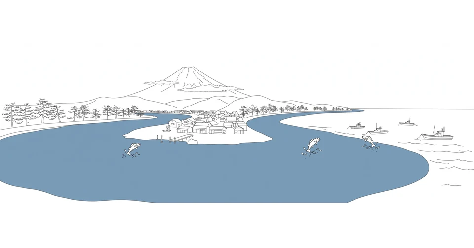
The Kano River has fed Numazu, flooded Numazu, and given Numazu its biggest summer party. Most visitors cross it without a glance on their way to the port. That is a pity, because once you know this river, the city makes a different kind of sense.
From the Amagi mountains to the sea
The Kano River begins high in the Amagi mountains, the wet volcanic range at the heart of the Izu Peninsula, where the water gathers around the hot spring town of Yugashima. Up there the young Kano River is a mountain stream, tumbling past the Joren Falls, a 25 metre drop counted among the hundred finest waterfalls in Japan, and running through a valley that Japanese writers have loved for a century. Kawabata Yasunari and other novelists set stories in this upper basin, and the river in their pages is always the same one: clear, cold and in a hurry.
The basin the Kano River drains is stitched with hot spring towns, and the upper river runs within earshot of bathhouse steam for much of its first half. Yugashima sits directly on the water, its inns lined along the banks, while Shuzenji, on one of the tributaries, guards a little spring called Tokko no Yu that rises right beside the stream. In Izu, a river is never only a river. It is also the reason the baths are hot.
From the mountains the Kano River runs north across the Tagata plain, gathering smaller streams as it goes, a first class river with a basin of about 850 square kilometres. It passes old castle towns and rice fields, and near its end it is joined by a small wonder. The Kakita River, barely more than a kilometre long, flows with spring water alone, much of it rain and snow that fell on Mount Fuji and spent decades filtering through the lava of its foothills before rising here, a few minutes from the sea.
Below that meeting the Kano River turns through the town of Shimizu, cuts through the middle of Numazu itself, and arrives at Suruga Bay beside the port. Few rivers in Japan pack so much change into so short a run: waterfall, onsen valley, farmland, springs, a city centre and a fishing harbour, all inside one morning's drive.
The Kano River and its ayu
If the Kano River has a flavour, it is ayu, the sweetfish that Japanese cooks prize above every other river fish. Ayu live fast and die young, spending a single year growing fat on algae in clean running water, and the Kano River has been ayu water for as long as anyone has kept records. The transport ministry's own portrait of the river says the Kano River is said to be the birthplace of tomozuri, the decoy method in which an angler works a live ayu on a line to defend its territory against rivals, provoking the attack that hooks them.
When the season opens in early summer, anglers in waders appear all along the upper and middle Kano River, standing motionless in the current for hours. The inns of the Yugashima valley put the catch on their menus, grilled whole with salt in the classic style, the flesh faintly sweet and faintly bitter at once. I have eaten ayu in fancier places since, but the honest version belongs to rivers like this one, eaten a short walk from the water it came out of.
The cormorant fishing that ended
The Kano River once had a stranger fishery than any angler. Cormorant fishing, ukai, in which trained birds dive for ayu under torchlight while their master works their leashes, was performed on this river centuries ago. The story told in the river's official history is that in the Muromachi period the warlord Hojo Soun had cormorant masters brought from the famous Nagara River to stage a performance here, and the custom took root. As late as the early nineteen hundreds, the future Emperor Taisho came to watch ukai on the Kano River as crown prince, and a stone monument near Ohito still marks the occasion.
The same official history then adds a quiet, almost apologetic line: cormorant fishing is no longer carried out on the Kano River. Nobody banned it in anger. Japan simply changed around it, the river traffic grew, the fish runs thinned, and a performance that needed darkness, silence and patience lost its place. What survives is the monument, and a certain wistfulness. Some traditions end with a ceremony. This one ended by becoming a stone beside the road.
A river with a long memory of floods
The Kano River earns respect the hard way. Izu is one of the rainiest corners of Japan, and the Kano River drops steeply out of it, so heavy rain upstream becomes fast, violent water downstream. In September 1958 a typhoon, remembered across Japan simply as the Kanogawa Typhoon after this river, tore through the basin and killed 1,269 people along its banks. It remains the defining disaster of the region, and a local society in the valley still collects photographs and testimony so that schoolchildren grow up knowing what the water can do.
The engineering answer came in the form of a shortcut. About 15 kilometres above the mouth, a diversion canal now branches away from the Kano River and carries floodwater through tunnels on a 2.9 kilometre shortcut straight to Suruga Bay, letting the worst of a storm pass the city by. The wide green banks through central Numazu are part of the same bargain: room for the river to rise, given back to the city as parks and playing fields the rest of the year.
I find that arrangement quietly moving. Numazu did not wall its river away or pretend the danger was gone. It built the flood a road of its own and kept living next door.
Life on the banks in Numazu
Most days, the lower Kano River belongs to ordinary pleasure. Runners and cyclists use the riverside paths, old men fish from the banks, and on clear days, above all in winter, Mount Fuji stands at the end of the view. In one central district the city has opened the bank as a terrace, with barbecues, rental kayaks and a small waterside stage, an attempt to pull the town back towards the water it grew up beside.
Summer belongs to the river outright. The city holds its great fireworks over the Kano River, families spread mats along the bank, and lanterns are floated downstream for the dead. An older rite sends rafts of burning torches down the current to honour the river god, part prayer and part apology from a town that knows exactly what the water gives and what it takes.
At the mouth, a small ferry, the Gannondo crossing, has been revived to carry walkers and cyclists across the Kano River where road traffic never could. Step off on the far side and the shore runs east into the pines of Senbon Matsubara, which begin right at the river mouth. On the near side stands Numazu Port, where the fleet lands the catch of Suruga Bay a few hundred metres from where the river ends. Mountain water and sea water meet here, and the city's two great food traditions, river ayu and bay fish, turn out to be neighbours.
The river that runs through everything
Numazu is usually described as a port city, and so it is, but the port is only the last page of the story. The Kano River decided where the town would stand, fed its fields, powered its summers, frightened it, entertained it, and still runs through the middle of daily life, mostly unnoticed. Cities in Japan are full of rivers that have been tamed into scenery. The Kano River has kept more of its character than most: a working river, a dangerous river, a delicious river.
Next time you cross one of its bridges, it is worth stopping in the middle for a minute. Look upstream towards the green wall of Izu, then downstream to the masts and the bay. The whole biography of Numazu runs between those two views, and it is still being written, one rainy season at a time.
More in Culture & Society
- The Tengger Carry Their Dead Out of the Village in Entas-Entas
- Urashima Opened the Tamatebako and Time Came to Collect
- How Supersemar Borrowed the Authority of a God
- Bali Has Its Own Semar, and His Name Is Twalen
- White Silk Means You Made It as a Sekitori
- The Dohyo-Iri Gives a Yokozuna Three Minutes to Own the Ring
Latest posts
- A Glass of Cannonau a Day in the Sardinian Hills
- A Rotenburo Is a Bath With Weather
- Katsuobushi Is a Fish You Shave Like a Block of Wood
- Nobody Commutes to a Heya
- Why Kagami Mochi Is Never Cut With a Knife
- Narazuke Pickles Spend Years Asleep in Sake Lees
- Tokyo Keeps a Hundred Tiny Fujis Called Fujizuka
- Tomozuri Sends a Living Fish to Do the Fishing
- One Thousand Three Hundred Years of Ukai Nights on the Nagara River
- Fuji Ko, the Pilgrim Societies That Climbed Mount Fuji Together
- Dashi, the Quiet Stock Under Almost Everything Japan Cooks
- Ayu, the Sweetfish That Rules Japan's Clear Rivers
- Gensen Kakenagashi, the Onsen Water That Never Circles Back
- Shiko, the Leg Stamp That Starts Every Sumo Day
- Semar, the God Who Chose to Work as a Servant